Papplewick, NG15
Introduction
The photograph on this page of Papplewick, NG15 by David Hallam-Jones as part of the Geograph project.
The Geograph project started in 2005 with the aim of publishing, organising and preserving representative images for every square kilometre of Great Britain, Ireland and the Isle of Man.

There are currently over 7.5m images from over 14,400 individuals and you can help contribute to the project by visiting https://www.geograph.org.uk
Papplewick, NG15
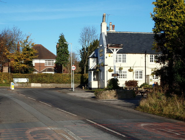
Image: © David Hallam-Jones Taken: 17 Nov 2012
The Griffin's Head pub is seen here at the crossroads with the B6011, with the majority of Moor Road (the B683 road) behind the photographer. The road stretches back for several miles behind the photographer forming a T junction with the A611 (Nottingham-Hucknall) Road. The pub is Grade II-listed, having been built during the 18-19th century. The Griffin's head symbol may have stemmed from this creature's appearance on the family crest of the Montagu's of Papplewick Hall, one of whom was Charles Montagu the M.P., who died in 1759.
Images are licensed for reuse under creativecommons.org/licenses/by-sa/2.0
Image Location
Latitude
53.053897
Longitude
-1.18269