Millburn Kirkyard: Matheson Memorial (detail)
Introduction
The photograph on this page of Millburn Kirkyard: Matheson Memorial (detail) by Lairich Rig as part of the Geograph project.
The Geograph project started in 2005 with the aim of publishing, organising and preserving representative images for every square kilometre of Great Britain, Ireland and the Isle of Man.

There are currently over 7.5m images from over 14,400 individuals and you can help contribute to the project by visiting https://www.geograph.org.uk
Millburn Kirkyard: Matheson Memorial (detail)
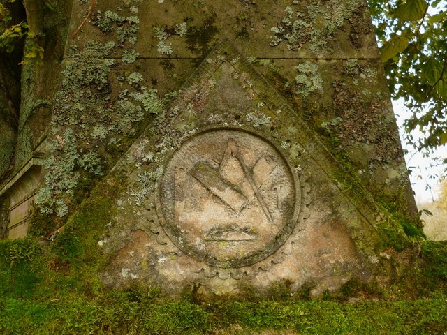
Image: © Lairich Rig Taken: 22 Oct 2012
The memorial is in the form of an obelisk, but with three sides. On the upper part, the compasses and square are flanked by a saw and a hammer; the symbol below them is harder to make out, but is probably a crown. See Image for the whole structure. Many of the stones in the kirkyard bear similar symbols; compare Image
Images are licensed for reuse under creativecommons.org/licenses/by-sa/2.0
Image Location
Latitude
55.975925
Longitude
-4.585531