Old archway
Introduction
The photograph on this page of Old archway by Lairich Rig as part of the Geograph project.
The Geograph project started in 2005 with the aim of publishing, organising and preserving representative images for every square kilometre of Great Britain, Ireland and the Isle of Man.

There are currently over 7.5m images from over 14,400 individuals and you can help contribute to the project by visiting https://www.geograph.org.uk
Old archway
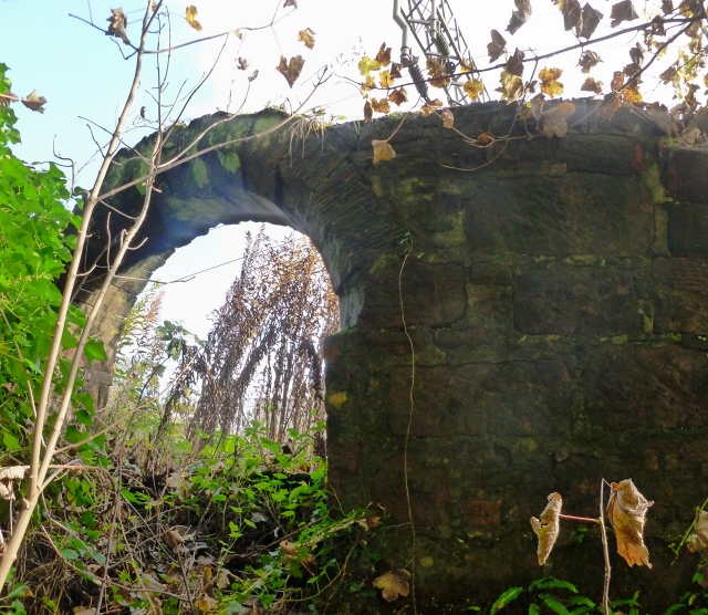
Image: © Lairich Rig Taken: 22 Oct 2012
This arch is between a path and the railway line; for context, see Image and Image It is probably a remnant of one of the buildings associated with the old Millburn Pyroligneous Works (whose former site is now occupied by a depot: Image). The Vale of Leven website has a page – http://www.valeofleven.org.uk/pyroligneous.html – with old pictures of the works. Photo 11 on that page shows some arches in the background, similar to the one in my picture. However, the one in my photo is on the other side of the railway line, and not below it; it is most probably not far from the arch that is on the right in the old photograph. The other two arches in the old photo, the pair on the left, are still present, and can be seen in Image; the path now leads through the one on the left, and the burn flows through the one on the right (that arch is harder to see because it is obscured by the modern fence).
Images are licensed for reuse under creativecommons.org/licenses/by-sa/2.0
Image Location
Latitude
55.977441
Longitude
-4.586113