Linby, NG15
Introduction
The photograph on this page of Linby, NG15 by David Hallam-Jones as part of the Geograph project.
The Geograph project started in 2005 with the aim of publishing, organising and preserving representative images for every square kilometre of Great Britain, Ireland and the Isle of Man.

There are currently over 7.5m images from over 14,400 individuals and you can help contribute to the project by visiting https://www.geograph.org.uk
Linby, NG15
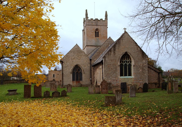
Image: © David Hallam-Jones Taken: 17 Nov 2012
The much restored and extended Anglican church of St Michael is said to date back to the 13th century. In this picture the photographer has Church Lane behind him. Originally the church was a plain rectangular building consisting of chancel, nave and a small tower. At some time in the 15th century a south aisle was added, and in the next century the porch. At the same time as the construction of the porch another stage was added to the tower, which is square, pinnacled, and unbuttressed. At a later date the porch was moved from the south to the north side of the church, its old position still visible via markings on the outside of the south wall.
Images are licensed for reuse under creativecommons.org/licenses/by-sa/2.0
Image Location
Latitude
53.052603
Longitude
-1.2039