Yew Tree Swing Bridge, Droylsden
Introduction
The photograph on this page of Yew Tree Swing Bridge, Droylsden by David Dixon as part of the Geograph project.
The Geograph project started in 2005 with the aim of publishing, organising and preserving representative images for every square kilometre of Great Britain, Ireland and the Isle of Man.

There are currently over 7.5m images from over 14,400 individuals and you can help contribute to the project by visiting https://www.geograph.org.uk
Yew Tree Swing Bridge, Droylsden
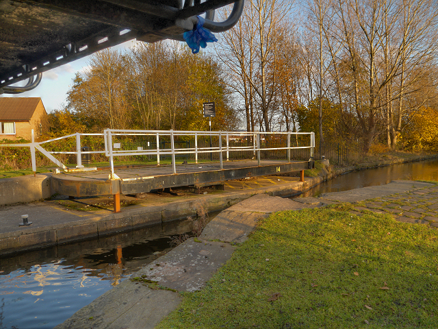
Image: © David Dixon Taken: 15 Nov 2012
Yew Tree footbridge and swing bridge are at the end of Buxton Lane. The crossing is named after a nearby pub, now closed (Image]). There was once a "Yew Tree Farm" in the area. Note: I have seen this bridge referred to as "Grimshaw's Bridge" ( http://www.narrowboatworld.com/index.php/news-flash/4395-bw-pays-p500000-compensation Narrowboat World) but the British Waterways sign next to the bridge names it as "Yew Tree Bridge" (Image]).
Images are licensed for reuse under creativecommons.org/licenses/by-sa/2.0
Image Location
Latitude
53.476908
Longitude
-2.161328