River Roding in Barking
Introduction
The photograph on this page of River Roding in Barking by Nigel Cox as part of the Geograph project.
The Geograph project started in 2005 with the aim of publishing, organising and preserving representative images for every square kilometre of Great Britain, Ireland and the Isle of Man.

There are currently over 7.5m images from over 14,400 individuals and you can help contribute to the project by visiting https://www.geograph.org.uk
River Roding in Barking
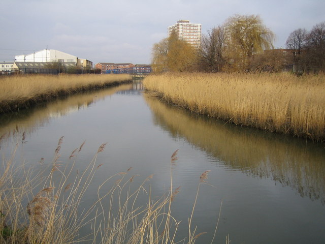
Image: © Nigel Cox Taken: 26 Jan 2007
Looking upstream, the footbridge in Image and the tower blocks in Image can both be seen in the distance. The reed beds visible along this reach of the river are important, and in this area, unique wildlife environments. In a couple of places the river has meandered in the past, but the meanders have subsequently silted up allowing the reeds to grow. However the organization that was responsible for building the flood defence walls has gone to great lengths to preserve the reeds by building the wall around the outskirts of the old meander line.
Images are licensed for reuse under creativecommons.org/licenses/by-sa/2.0
Image Location
Latitude
51.53934
Longitude
0.069215