Droylsden Tram Stop
Introduction
The photograph on this page of Droylsden Tram Stop by David Dixon as part of the Geograph project.
The Geograph project started in 2005 with the aim of publishing, organising and preserving representative images for every square kilometre of Great Britain, Ireland and the Isle of Man.

There are currently over 7.5m images from over 14,400 individuals and you can help contribute to the project by visiting https://www.geograph.org.uk
Droylsden Tram Stop
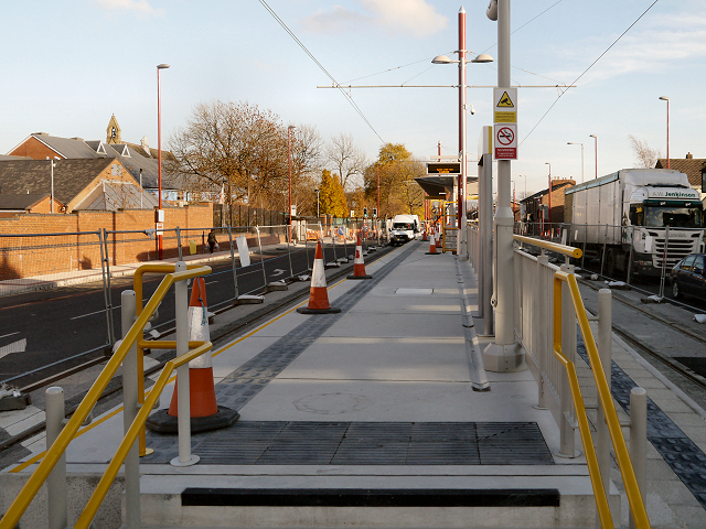
Image: © David Dixon Taken: 15 Nov 2012
Looking along the island platform of the new Droylsden Tram stop on Ashton Road, just to the east of Market Street. This stop will operate as the temporary terminus for the Metrolink East Manchester Line Extension; a facing connection will allow trams from the outbound platform to move forward and onto the inbound line to reverse and return towards Manchester. The East Manchester line will eventually run to Ashton-Under-Lyne; the section between Manchester Piccadilly and Droylsden is scheduled to open “before Christmas 2012”. http://www.lrta.org/Manchester/ashton.html LRT Association "Metrolink - Manchester to Droylsden and Ashton-Under-Lyne" http://www.metrolink.co.uk/futuremetrolink/Pages/east-manchester-line.aspx Transport for Greater Manchester - Metrolink East Manchester Line
Images are licensed for reuse under creativecommons.org/licenses/by-sa/2.0
Image Location
Latitude
53.479445
Longitude
-2.145366