Reeve Castle
Introduction
The photograph on this page of Reeve Castle by David Smith as part of the Geograph project.
The Geograph project started in 2005 with the aim of publishing, organising and preserving representative images for every square kilometre of Great Britain, Ireland and the Isle of Man.

There are currently over 7.5m images from over 14,400 individuals and you can help contribute to the project by visiting https://www.geograph.org.uk
Reeve Castle
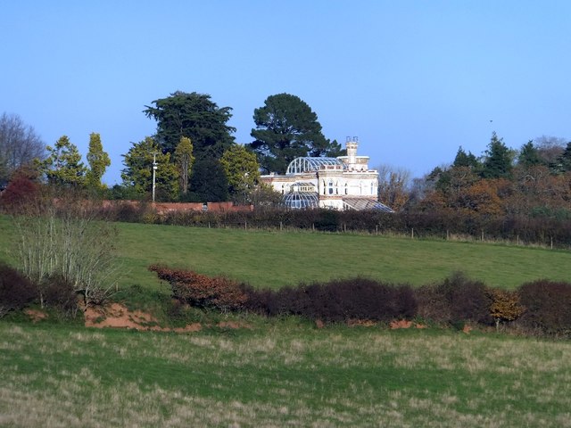
Image: © David Smith Taken: 14 Nov 2012
A folly castle dating from 1900, described in http://www.guardian.co.uk/money/2004/sep/12/property.observercashsection and http://www.britishlistedbuildings.co.uk/en-95626-reeve-castle-incuding-adjoining-glasshous. Pevsner (Buildings of England - Devon, 1989) gives this as the last building in the county. Perhaps reflecting on the period when the interior was stripped of its fittings, the commentary ends: "Best seen from a distance". This picture was taken from near Burrow, a distance of nearly half-a-mile away. The water tower that supplied the garden's water features is in Image]
Images are licensed for reuse under creativecommons.org/licenses/by-sa/2.0
Image Location
Latitude
50.810957
Longitude
-3.833485