Queens Point and the former Croy Lodge
Introduction
The photograph on this page of Queens Point and the former Croy Lodge by Lairich Rig as part of the Geograph project.
The Geograph project started in 2005 with the aim of publishing, organising and preserving representative images for every square kilometre of Great Britain, Ireland and the Isle of Man.

There are currently over 7.5m images from over 14,400 individuals and you can help contribute to the project by visiting https://www.geograph.org.uk
Queens Point and the former Croy Lodge
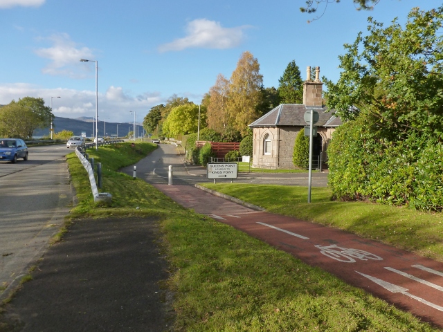
Image: © Lairich Rig Taken: 15 Oct 2012
The road branching off to the right is called Image (the sign says "Queens Point leading to Kings Point"). The building at the corner was a lodge associated with Croy. Croy House itself dates from 1834, and is at Image The cycle path is part of Regional Route 42.
Images are licensed for reuse under creativecommons.org/licenses/by-sa/2.0
Image Location
Latitude
56.032158
Longitude
-4.797022