Access road in Shandon
Introduction
The photograph on this page of Access road in Shandon by Lairich Rig as part of the Geograph project.
The Geograph project started in 2005 with the aim of publishing, organising and preserving representative images for every square kilometre of Great Britain, Ireland and the Isle of Man.

There are currently over 7.5m images from over 14,400 individuals and you can help contribute to the project by visiting https://www.geograph.org.uk
Access road in Shandon
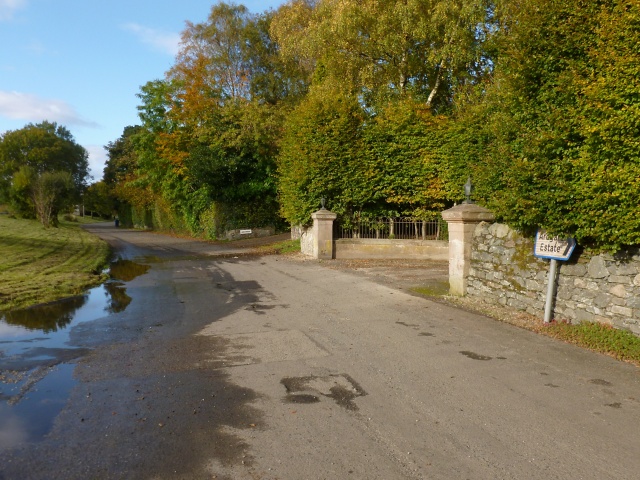
Image: © Lairich Rig Taken: 15 Oct 2012
This road runs parallel to the main road (the A814), but is quieter, providing access to houses on its eastern side. For example, the gateposts just ahead mark the start of the driveway to a house called Letrualt (the house was built in 1855 and extended in 1864; there used to be a farmstead of the same name – http://www.geograph.org.uk/snippet/8024 – on the hillside about 900 metres to the north).
Images are licensed for reuse under creativecommons.org/licenses/by-sa/2.0
Image Location
Latitude
56.038499
Longitude
-4.80278