Barrier on Private Road, Mapperley Park
Introduction
The photograph on this page of Barrier on Private Road, Mapperley Park by Richard Vince as part of the Geograph project.
The Geograph project started in 2005 with the aim of publishing, organising and preserving representative images for every square kilometre of Great Britain, Ireland and the Isle of Man.

There are currently over 7.5m images from over 14,400 individuals and you can help contribute to the project by visiting https://www.geograph.org.uk
Barrier on Private Road, Mapperley Park
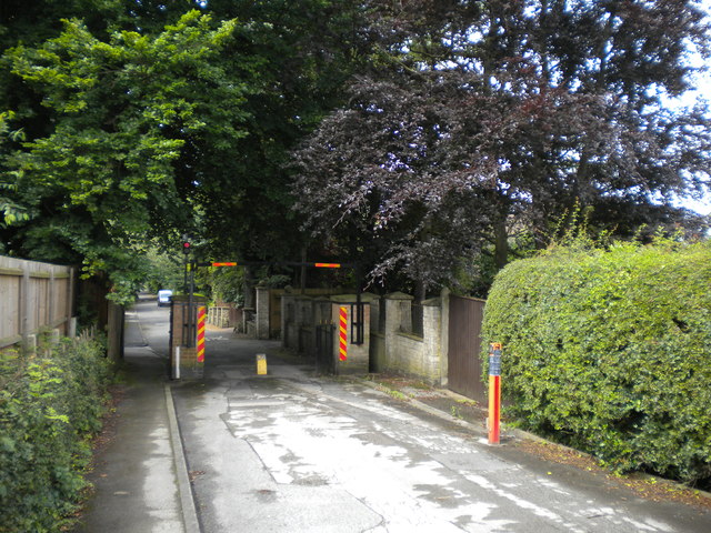
Image: © Richard Vince Taken: 14 Jul 2012
This barrier prevents Private Road from being used by through traffic between Mansfield Road (out of sight in the distance) and Woodborough Road (some way behind the photographer). The rising bollard type device can be retracted by residents using some sort of electronic device.
Images are licensed for reuse under creativecommons.org/licenses/by-sa/2.0
Image Location
Latitude
52.979425
Longitude
-1.138819