"Browns" manhole cover, Rushpark, Newtownabbey
Introduction
The photograph on this page of "Browns" manhole cover, Rushpark, Newtownabbey by Albert Bridge as part of the Geograph project.
The Geograph project started in 2005 with the aim of publishing, organising and preserving representative images for every square kilometre of Great Britain, Ireland and the Isle of Man.

There are currently over 7.5m images from over 14,400 individuals and you can help contribute to the project by visiting https://www.geograph.org.uk
"Browns" manhole cover, Rushpark, Newtownabbey
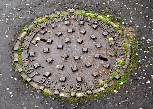
Image: © Albert Bridge Taken: 13 Nov 2012
A manhole cover, from the now-closed Browns foundry, Sydney Street West, Belfast, at The Oaks in the Rushpark estate. The two tower blocks Image date from 1964 which gives a clue to when the cover was cast.
Images are licensed for reuse under creativecommons.org/licenses/by-sa/2.0
Image Location
Latitude
54.662897
Longitude
-5.908294