Rear of pillbox, George Lane, Marlborough
Introduction
The photograph on this page of Rear of pillbox, George Lane, Marlborough by Brian Robert Marshall as part of the Geograph project.
The Geograph project started in 2005 with the aim of publishing, organising and preserving representative images for every square kilometre of Great Britain, Ireland and the Isle of Man.

There are currently over 7.5m images from over 14,400 individuals and you can help contribute to the project by visiting https://www.geograph.org.uk
Rear of pillbox, George Lane, Marlborough
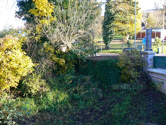
Image: © Brian Robert Marshall Taken: 11 Nov 2012
The pillbox is hard to spot as it seems to have sunk somewhat in the softish ground on the banks of the River Kennet. It was part of the GHQ 'Blue' stop line installed along the line from Reading to Melksham in 1940 to act as a line of resistance against German forces which were expected to invade in the early years of the second world war. It is one of several pillboxes in the town most of which have long since been removed. For another view see Image
Images are licensed for reuse under creativecommons.org/licenses/by-sa/2.0
Image Location


Leaflet Map data © OpenStreetMap
Latitude
51.416202
Longitude
-1.732343