The Crumbles
Introduction
The photograph on this page of The Crumbles by Bill Ross as part of the Geograph project.
The Geograph project started in 2005 with the aim of publishing, organising and preserving representative images for every square kilometre of Great Britain, Ireland and the Isle of Man.

There are currently over 7.5m images from over 14,400 individuals and you can help contribute to the project by visiting https://www.geograph.org.uk
The Crumbles
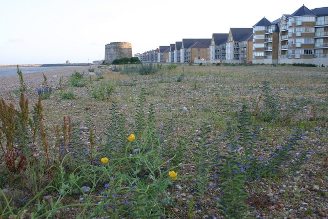
Image: © Bill Ross Taken: 9 Jul 2006
Martello Tower 64 used to sit in splendid isolation on the acres of 'the Crumbles' shingle banks. All that remains of the flora of that landscape is squeezed in to this tiny strip of beach. Certainly kept the map makers busy in recent years.
Images are licensed for reuse under creativecommons.org/licenses/by-sa/2.0
Image Location
Latitude
50.79578
Longitude
0.335904