Part of the east side of Monmouth School
Introduction
The photograph on this page of Part of the east side of Monmouth School by Jaggery as part of the Geograph project.
The Geograph project started in 2005 with the aim of publishing, organising and preserving representative images for every square kilometre of Great Britain, Ireland and the Isle of Man.

There are currently over 7.5m images from over 14,400 individuals and you can help contribute to the project by visiting https://www.geograph.org.uk
Part of the east side of Monmouth School
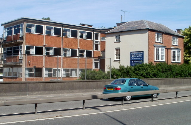
Image: © Jaggery Taken: 2 May 2011
Viewed across the A40. These are some of the newer buildings in Monmouth School, a boarding and day school for boys aged 7-18. Monmouth School was established in 1614 but nothing remains of the original buildings. Many of the school buildings date from 1865, when the school was substantially rebuilt on the same site. Here http://www.geograph.org.uk/photo/2098646 is a more typical part of the school.
Images are licensed for reuse under creativecommons.org/licenses/by-sa/2.0
Image Location
Latitude
51.810507
Longitude
-2.711714