The Square, Findon
Introduction
The photograph on this page of The Square, Findon by Stefan Czapski as part of the Geograph project.
The Geograph project started in 2005 with the aim of publishing, organising and preserving representative images for every square kilometre of Great Britain, Ireland and the Isle of Man.

There are currently over 7.5m images from over 14,400 individuals and you can help contribute to the project by visiting https://www.geograph.org.uk
The Square, Findon
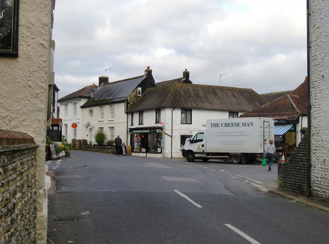
Image: © Stefan Czapski Taken: 8 Nov 2012
Looking north from outside the Gun Inn. School Lane crosses immediately ahead, and beyond it the High Street continues as the Horsham Road. Straight ahead, on the opposite corner, is the Southdown Saddlery, with the local post office to the left, while behind the delivery van is the village butcher's shop. I think it's worth pointing out that within living memory this quiet village street was the main London-Worthing road. According to Valerie Martin's excellent village website, Findon by-pass was completed in 1939: http://www.findonvillage.com/0055_the_train_takes_the_strain.htm
Images are licensed for reuse under creativecommons.org/licenses/by-sa/2.0
Image Location
Latitude
50.868277
Longitude
-0.407044