Mesopotamia Walk
Introduction
The photograph on this page of Mesopotamia Walk by Des Blenkinsopp as part of the Geograph project.
The Geograph project started in 2005 with the aim of publishing, organising and preserving representative images for every square kilometre of Great Britain, Ireland and the Isle of Man.

There are currently over 7.5m images from over 14,400 individuals and you can help contribute to the project by visiting https://www.geograph.org.uk
Mesopotamia Walk
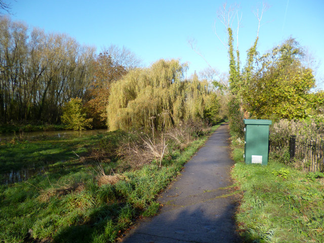
Image: © Des Blenkinsopp Taken: 7 Nov 2012
I don't know if this name is still in use for this piece of land, but here is what Wikipedia says about it: "Mesopotamia is a narrow island (about 800 yards long by 30 yards wide) that forms part of the University Parks. It lies between the upper and lower levels of the River Cherwell. The name Mesopotamia in Greek means 'between the rivers' and originally referred to the area between the Tigris and Euphrates rivers in present-day Iraq. The land was purchased by the University of Oxford during the expansion of the Oxford University Parks between 1860 and 1865. A footpath, Mesopotamia Walk, laid out in 1865 runs along the centre of the spur to Kings Mill. "The Domesday Book records a watermill on this site and milling continued until 1825; one level of the river was once the mill stream. From 1914, attempts were made to introduce wild ducks and geese to the area, but these proved fruitless because of the predatory local otter population. Until 1926, a ferry operated from a point halfway along the Walk, when it was replaced by a footbridge." The green kiosk is an Environment Agency flood warning station which monitors river levels.
Images are licensed for reuse under creativecommons.org/licenses/by-sa/2.0
Image Location
Latitude
51.756616
Longitude
-1.2392