National Cycle Network Sign
Introduction
The photograph on this page of National Cycle Network Sign by David Dixon as part of the Geograph project.
The Geograph project started in 2005 with the aim of publishing, organising and preserving representative images for every square kilometre of Great Britain, Ireland and the Isle of Man.

There are currently over 7.5m images from over 14,400 individuals and you can help contribute to the project by visiting https://www.geograph.org.uk
National Cycle Network Sign
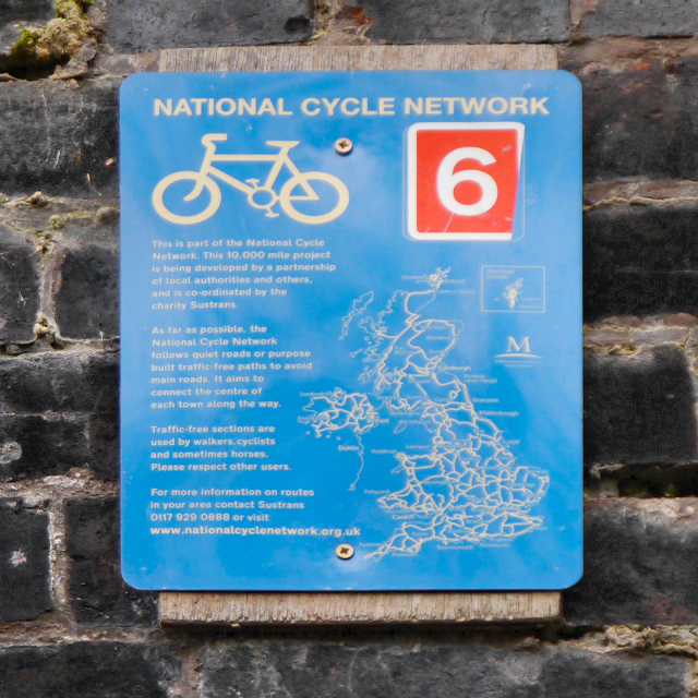
Image: © David Dixon Taken: 7 Nov 2012
Sign attached to the bridge at Nelstrop Road (Image]). It reads: This is part of the National Cycle Network. This 10,000 mile project is being developed by a partnership of local authorities and others, and is co-ordinated by the charity Sustrans. As far as possible, the National Cycle Network follows quiet roads or purpose built traffic-free paths to avoid main roads. It aims to connect the centre of each town along the way. Traffic free sections are used by walkers, cyclists and sometimes horses. Please respect other users. For more information on routes in your area contact Sustrans 0117 929 0888 or visit www.nationalcyclenetwork.org.uk
Images are licensed for reuse under creativecommons.org/licenses/by-sa/2.0
Image Location
Latitude
53.443633
Longitude
-2.173848