Ripening crops near Grindon
Introduction
The photograph on this page of Ripening crops near Grindon by Blaise Vyner as part of the Geograph project.
The Geograph project started in 2005 with the aim of publishing, organising and preserving representative images for every square kilometre of Great Britain, Ireland and the Isle of Man.

There are currently over 7.5m images from over 14,400 individuals and you can help contribute to the project by visiting https://www.geograph.org.uk
Ripening crops near Grindon
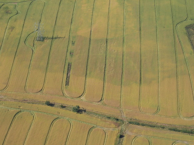
Image: © Blaise Vyner Taken: 16 Jul 2006
The obvious feature here is the pylon and the shadow it is throwing across the ripening grain crop. The extent of ripening varies according to the underlying geology. Within the dark area you can see the traces of a line of slightly lighter colour, marking the ditch of a long-vanished, probably Iron Age, enclosure (Hint: follow a line from the end of the pylon shadow downwards towards five oclock and you'll cross the top left rounded corner of the enclosure).
Images are licensed for reuse under creativecommons.org/licenses/by-sa/2.0
Image Location


Leaflet Map data © OpenStreetMap
Latitude
54.609567
Longitude
-1.36132