The Admiral Inn
Introduction
The photograph on this page of The Admiral Inn by Ian Capper as part of the Geograph project.
The Geograph project started in 2005 with the aim of publishing, organising and preserving representative images for every square kilometre of Great Britain, Ireland and the Isle of Man.

There are currently over 7.5m images from over 14,400 individuals and you can help contribute to the project by visiting https://www.geograph.org.uk
The Admiral Inn
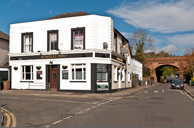
Image: © Ian Capper Taken: 2 Nov 2012
This pub stands at the junction of Albert Road North and Nutley Lane. The first records date from 1871. In the background is the railway bridge carrying the Redhill - Guildford "North Downs Line", with the trees in the far distance being on the crest of the North Downs. Compare Image, showing earlier paintwork.
Images are licensed for reuse under creativecommons.org/licenses/by-sa/2.0
Image Location
Latitude
51.242809
Longitude
-0.21193