Mountainview Tavern, Upper Shankill
Introduction
The photograph on this page of Mountainview Tavern, Upper Shankill by Eric Jones as part of the Geograph project.
The Geograph project started in 2005 with the aim of publishing, organising and preserving representative images for every square kilometre of Great Britain, Ireland and the Isle of Man.

There are currently over 7.5m images from over 14,400 individuals and you can help contribute to the project by visiting https://www.geograph.org.uk
Mountainview Tavern, Upper Shankill
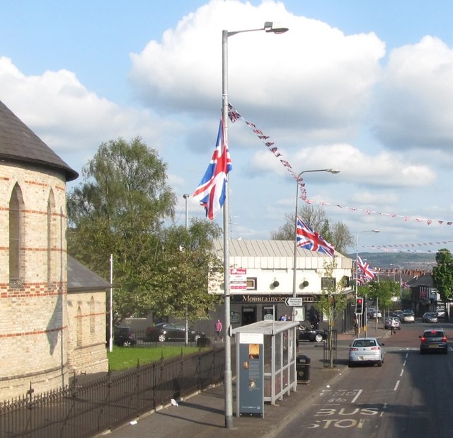
Image: © Eric Jones Taken: 19 May 2012
The bombing of this pub in 1975, resulting in five deaths and the injuring of a further 60, remains the subject of an active investigation by the PSNI Historical Enquiries Team.The brick building on the left is St Mathew's CoI Parish Church
Images are licensed for reuse under creativecommons.org/licenses/by-sa/2.0
Image Location
Latitude
54.606006
Longitude
-5.959969