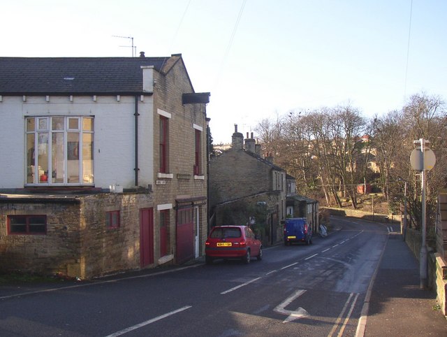
Jumble Dyke, Rastrick
Introduction
The photograph on this page of Jumble Dyke, Rastrick by Humphrey Bolton as part of the Geograph project.
The Geograph project started in 2005 with the aim of publishing, organising and preserving representative images for every square kilometre of Great Britain, Ireland and the Isle of Man.
There are currently over 7.5m images from over 14,400 individuals and you can help contribute to the project by visiting https://www.geograph.org.uk

Image: © Humphrey Bolton Taken: 22 Jan 2007
Part of the old road from Brighouse to Elland, turnpiked in the 18C but superseded by a new road in the Calder Valley in the 19C. I would be interested to know what the building on the left was – evidently a shop of some sort, with a blocked taking-in door and a girder for a hoist. The 1850 six-inch map shows a Smithy here. If you look at Image, at the corner of the road junction, probably in front of the steps, there was a turnpike road guide stone shown on the 1933 1:2500 map but probably taken away during the Second World War. I hope it in safe keeping, but where? On the Crowtrees Lane side "T Brook Sculptor, To JUNCTION 13 Miles, LEEDS 13 Miles, Anno Domini" On the Jumble Dyke side "To LEEDS 13 Miles, ELLAND 2 Miles, 1823".

