Poulton Hey
Introduction
The photograph on this page of Poulton Hey by Sue Adair as part of the Geograph project.
The Geograph project started in 2005 with the aim of publishing, organising and preserving representative images for every square kilometre of Great Britain, Ireland and the Isle of Man.

There are currently over 7.5m images from over 14,400 individuals and you can help contribute to the project by visiting https://www.geograph.org.uk
Poulton Hey
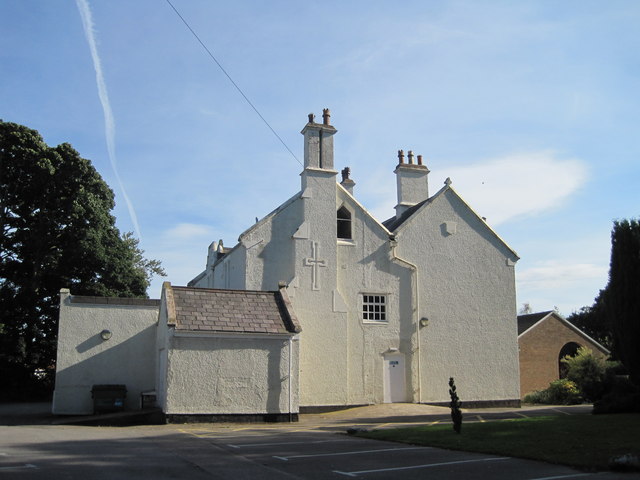
Image: © Sue Adair Taken: 6 Sep 2012
Originally the dower house of the Lancelyn Green family, built in 1843, but never used for this purpose, the house was used for church groups from 1968 until given to the parish of St Andrews by Roger Lancelyn Green in 1972. The Lancelyn family coat of arms features three stags and is visible on the right gable. In 1977 it was dedicated as a church itself and fulfilled this role until 1987 when the new building was erected. It is now the parish centre.
Images are licensed for reuse under creativecommons.org/licenses/by-sa/2.0
Image Location
Latitude
53.333406
Longitude
-3.000813