Development site, Dundonald (3)
Introduction
The photograph on this page of Development site, Dundonald (3) by Albert Bridge as part of the Geograph project.
The Geograph project started in 2005 with the aim of publishing, organising and preserving representative images for every square kilometre of Great Britain, Ireland and the Isle of Man.

There are currently over 7.5m images from over 14,400 individuals and you can help contribute to the project by visiting https://www.geograph.org.uk
Development site, Dundonald (3)
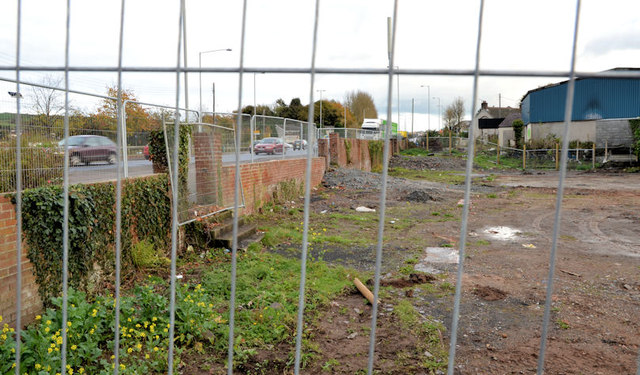
Image: © Albert Bridge Taken: 29 Oct 2012
A cleared but still undeveloped site, at the corner of the Upper Newtownards Road (left) and Burton Avenue, to which the following applies “Y/2006/0215/F 1027-1035 Upper Newtownards Road (odd numbers only), Ballyregan, Dundonald, Northern Ireland, BT16 1RN Redevelopment to include 32 No. 2 bedroom and 3 No. 1 bedroom apartments with associated site works and car parking Redevelopment to include 32 No. 2 bedroom and 3 No. 1 bedroom apartments with associated site works and car parking PERMISSION HAS BEEN GRANTED 18/08/2006”. Note added on 6 December 2012: this site is now the subject of the following application for planning permission: “0304/F 1027-1035 Upper Newtownards Road (odd numbers only) Ballybeen , Dundonald Erection of social housing scheme of 32 No apartments in 2 No blocks (to include 20 No. 3 person 2 bed category 1 (active elderly) and 12 No. 3 person 2 bed generic needs) with associated parking and ancillary works”. This photograph appears as a matter of record only and does not express any opinion about the application.
Images are licensed for reuse under creativecommons.org/licenses/by-sa/2.0
Image Location
Latitude
54.594581
Longitude
-5.800232