The Ulster Hospital, Dundonald
Introduction
The photograph on this page of The Ulster Hospital, Dundonald by Albert Bridge as part of the Geograph project.
The Geograph project started in 2005 with the aim of publishing, organising and preserving representative images for every square kilometre of Great Britain, Ireland and the Isle of Man.

There are currently over 7.5m images from over 14,400 individuals and you can help contribute to the project by visiting https://www.geograph.org.uk
The Ulster Hospital, Dundonald
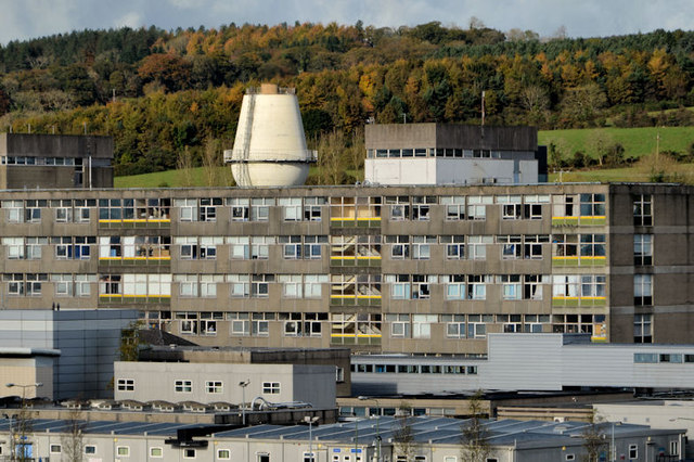
Image: © Albert Bridge Taken: 29 Oct 2012
See Image (May 2008). A similar view, more than four years later. This water tower Image is prominent behind the hospital buildings. The trees (background) are on the side of Craigantlet hill Image The view is from the top of Dundonald motte.
Images are licensed for reuse under creativecommons.org/licenses/by-sa/2.0
Image Location
Latitude
54.596665
Longitude
-5.811107