The Sixmilewater, Ballyclare (2)
Introduction
The photograph on this page of The Sixmilewater, Ballyclare (2) by Albert Bridge as part of the Geograph project.
The Geograph project started in 2005 with the aim of publishing, organising and preserving representative images for every square kilometre of Great Britain, Ireland and the Isle of Man.

There are currently over 7.5m images from over 14,400 individuals and you can help contribute to the project by visiting https://www.geograph.org.uk
The Sixmilewater, Ballyclare (2)
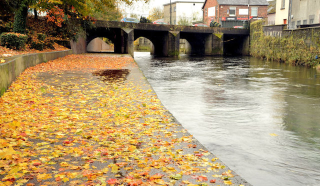
Image: © Albert Bridge Taken: 28 Oct 2012
See Image (November 2009). Just under three years later and another rainy day. The view is upstream towards the Town Bridge with a covering of wet autumn leaves on the path (left). The river is not shown on the Google map – see the satellite photograph.
Images are licensed for reuse under creativecommons.org/licenses/by-sa/2.0
Image Location
Latitude
54.750486
Longitude
-5.997909