Sheffield, S1 - Canal
Introduction
The photograph on this page of Sheffield, S1 - Canal by David Hallam-Jones as part of the Geograph project.
The Geograph project started in 2005 with the aim of publishing, organising and preserving representative images for every square kilometre of Great Britain, Ireland and the Isle of Man.

There are currently over 7.5m images from over 14,400 individuals and you can help contribute to the project by visiting https://www.geograph.org.uk
Sheffield, S1 - Canal
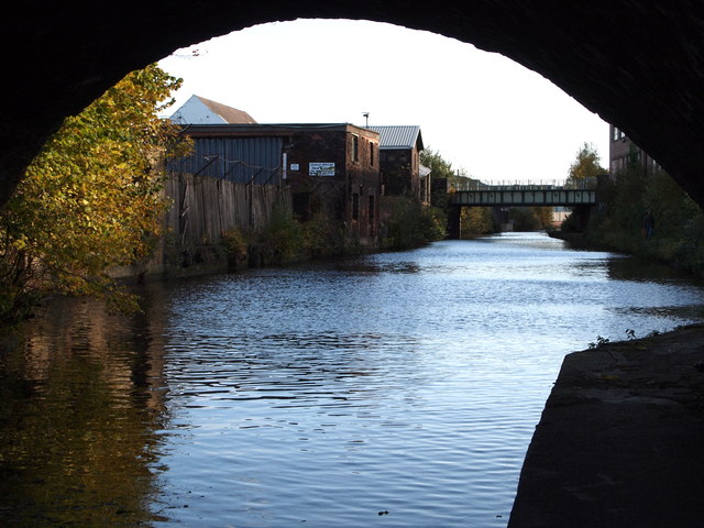
Image: © David Hallam-Jones Taken: 27 Oct 2012
A view along the Sheffield and Tinsley canal towards Tinsley, as seen through Cadman Bridge (built 1819). The Sheffield Canal Basin lies behind the photographer. The canal runs 3.9 miles (6.3kms) from the River Don, Tinsley to the city centre canal basin (renamed "Victoria Quays"), passing through 11 locks.
Images are licensed for reuse under creativecommons.org/licenses/by-sa/2.0
Image Location
Latitude
53.387141
Longitude
-1.453579