Sidmouth seafront
Introduction
The photograph on this page of Sidmouth seafront by Derek Harper as part of the Geograph project.
The Geograph project started in 2005 with the aim of publishing, organising and preserving representative images for every square kilometre of Great Britain, Ireland and the Isle of Man.

There are currently over 7.5m images from over 14,400 individuals and you can help contribute to the project by visiting https://www.geograph.org.uk
Sidmouth seafront
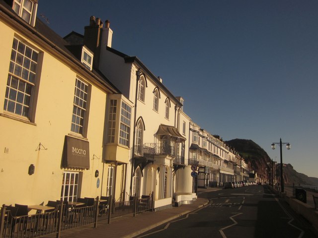
Image: © Derek Harper Taken: 27 Oct 2012
The Esplanade on a lovely autumn morning. On the left is the Mocha Cafe, described at http://list.english-heritage.org.uk/resultsingle.aspx?uid=1215960&searchtype=mapsearch , followed by Beach House, shown in Image, and listed grade II* http://list.english-heritage.org.uk/resultsingle.aspx?uid=1097933&searchtype=mapsearch . Past the mini-roundabout is York Terrace, starting with the Royal York Hotel http://list.english-heritage.org.uk/resultsingle.aspx?uid=1097935&searchtype=mapsearch .
Images are licensed for reuse under creativecommons.org/licenses/by-sa/2.0
Image Location
Latitude
50.678152
Longitude
-3.237512