South Middleton
Introduction
The photograph on this page of South Middleton by Andrew Curtis as part of the Geograph project.
The Geograph project started in 2005 with the aim of publishing, organising and preserving representative images for every square kilometre of Great Britain, Ireland and the Isle of Man.

There are currently over 7.5m images from over 14,400 individuals and you can help contribute to the project by visiting https://www.geograph.org.uk
South Middleton
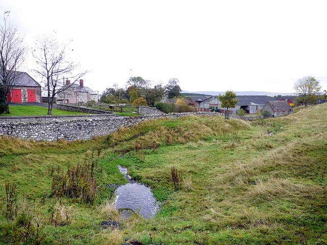
Image: © Andrew Curtis Taken: 26 Oct 2012
Similar view to Image Below is the outlet of water overflow from the millpond. It enters a culvert again just above the main farm buildings, passing under the road and emerging again on the other side.
Images are licensed for reuse under creativecommons.org/licenses/by-sa/2.0
Image Location


Leaflet Map data © OpenStreetMap
Latitude
55.503836
Longitude
-2.005514