Disused Library
Introduction
The photograph on this page of Disused Library by Mick Garratt as part of the Geograph project.
The Geograph project started in 2005 with the aim of publishing, organising and preserving representative images for every square kilometre of Great Britain, Ireland and the Isle of Man.

There are currently over 7.5m images from over 14,400 individuals and you can help contribute to the project by visiting https://www.geograph.org.uk
Disused Library
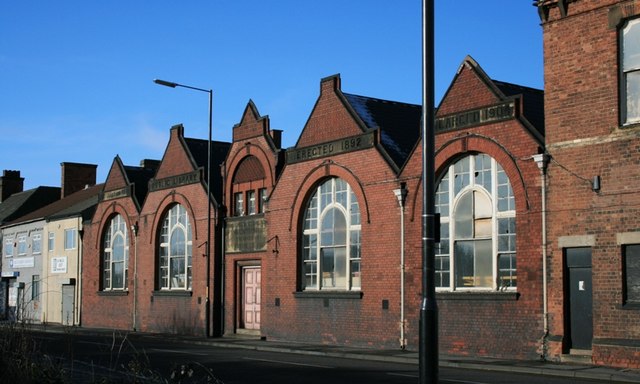
Image: © Mick Garratt Taken: 23 Jan 2007
Situated in what is known locally as the Thornaby Triangle, in effect an island surrounded by a busy one way system this once proud building now stands neglected. It was presented to the town in 1892 by T Wrightson Esq. of Head Wrightsons, the iron and steel company which occupied the substantial area of land on the banks of the Tees known as Thornaby Carrs. Head Wrightsons was obviously a major employer in the town.
Images are licensed for reuse under creativecommons.org/licenses/by-sa/2.0
Image Location
Latitude
54.556402
Longitude
-1.30293