Allotments, Canterbury, 1965
Introduction
The photograph on this page of Allotments, Canterbury, 1965 by Derek Harper as part of the Geograph project.
The Geograph project started in 2005 with the aim of publishing, organising and preserving representative images for every square kilometre of Great Britain, Ireland and the Isle of Man.

There are currently over 7.5m images from over 14,400 individuals and you can help contribute to the project by visiting https://www.geograph.org.uk
Allotments, Canterbury, 1965
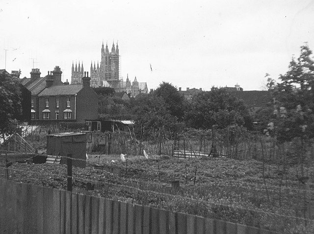
Image: © Derek Harper Taken: Unknown
The allotments are no longer there - they have been built over with housing around the line of Old Watling Street, and the terraces on St Peter's Grove on the left now join onto the new estate. As with the allotments, I think wherever I was standing when I took this has also changed fundamentally - I suspect it is now Rheims Way. However, the cathedral is still there.
Images are licensed for reuse under creativecommons.org/licenses/by-sa/2.0
Image Location
Latitude
51.278084
Longitude
1.07271