View from top of NatWest Tower 1983
Introduction
The photograph on this page of View from top of NatWest Tower 1983 by Richard Hoare as part of the Geograph project.
The Geograph project started in 2005 with the aim of publishing, organising and preserving representative images for every square kilometre of Great Britain, Ireland and the Isle of Man.

There are currently over 7.5m images from over 14,400 individuals and you can help contribute to the project by visiting https://www.geograph.org.uk
View from top of NatWest Tower 1983
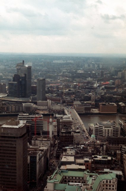
Image: © Richard Hoare Taken: Unknown
Taken whilst working in the City at the time this shows Gracechurch Street and London Bridge. From a scanned photograph. No Shard or Gherkin yet but view a changing / changed skyline by opening Tam Nugents excellent aerial shot Image] Others includeImage] Image] Image] Image]
Images are licensed for reuse under creativecommons.org/licenses/by-sa/2.0
Image Location
Latitude
51.514245
Longitude
-0.083976