Roundhill Inn, Clough Lane, Rastrick
Introduction
The photograph on this page of Roundhill Inn, Clough Lane, Rastrick by Humphrey Bolton as part of the Geograph project.
The Geograph project started in 2005 with the aim of publishing, organising and preserving representative images for every square kilometre of Great Britain, Ireland and the Isle of Man.

There are currently over 7.5m images from over 14,400 individuals and you can help contribute to the project by visiting https://www.geograph.org.uk
Roundhill Inn, Clough Lane, Rastrick
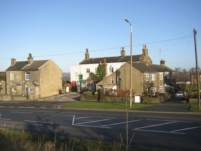
Image: © Humphrey Bolton Taken: 22 Jan 2007
This pub is not named on the 1850 6” map, and was perhaps established to take advantage of the adjacent cricket ground and the well-known landmark, Round Hill. The puib and the cottages are built in a strip of land that was probably enclosed from the roadside waste, Clough Lane being a medieval main road. The present alignment of the road and the cutting from the top of which the photograph has been taken are due to the construction of the M62.
Images are licensed for reuse under creativecommons.org/licenses/by-sa/2.0
Image Location
Latitude
53.681689
Longitude
-1.797087