Nos 508-510 Antrim Road, Belfast (1)
Introduction
The photograph on this page of Nos 508-510 Antrim Road, Belfast (1) by Albert Bridge as part of the Geograph project.
The Geograph project started in 2005 with the aim of publishing, organising and preserving representative images for every square kilometre of Great Britain, Ireland and the Isle of Man.

There are currently over 7.5m images from over 14,400 individuals and you can help contribute to the project by visiting https://www.geograph.org.uk
Nos 508-510 Antrim Road, Belfast (1)
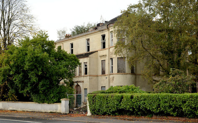
Image: © Albert Bridge Taken: 20 Oct 2012
A pair of very large semis, now vacant and semi derelict, close to the Old Cavehill Road, to which the following planning permission applies: “Z/2008/0119/F 10/01/2008 508-510 Antrim Road, Ballyaghagan, Belfast, BT15 5GG Demolition of existing building and erection of 9 No. apartments in a single block including carparking and landscaping” . . . “PERMISSION HAS BEEN GRANTED . . . 23/06/2008”. No 508 (left) is roofless. This photograph appears as a matter of geographical and historical record only. I have no connection with any of the parties involved in the proposed development. See also Image Note added 17 May 2013: now demolished.
Images are licensed for reuse under creativecommons.org/licenses/by-sa/2.0
Image Location
Latitude
54.63152
Longitude
-5.938558