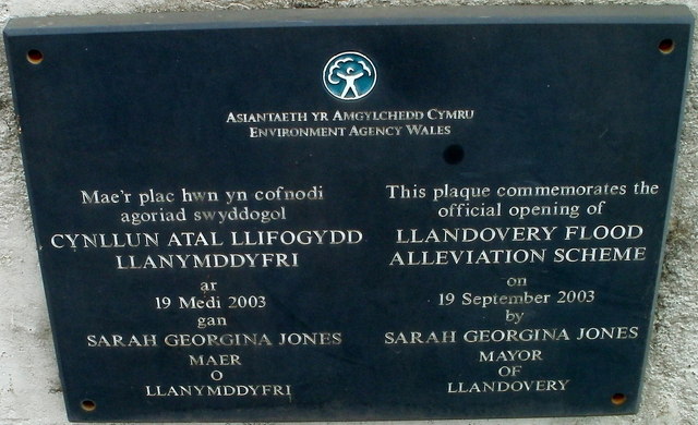
Llandovery Flood Alleviation Scheme plaque
Introduction
The photograph on this page of Llandovery Flood Alleviation Scheme plaque by Jaggery as part of the Geograph project.
The Geograph project started in 2005 with the aim of publishing, organising and preserving representative images for every square kilometre of Great Britain, Ireland and the Isle of Man.
There are currently over 7.5m images from over 14,400 individuals and you can help contribute to the project by visiting https://www.geograph.org.uk

Image: © Jaggery Taken: 5 Jun 2011
The plaque is on the south side of this bridge http://www.geograph.org.uk/photo/3186152 named Pont a'r Frân across the Afon Brân. The flood plains of four rivers are in Llandovery, parts of which have been repeatedly flooded by rivers overtopping their banks. This scheme included realignment of the river channel, bank protection and the construction of flood embankments and flood walls.

