3c Community Church, Upper Cam
Introduction
The photograph on this page of 3c Community Church, Upper Cam by Jaggery as part of the Geograph project.
The Geograph project started in 2005 with the aim of publishing, organising and preserving representative images for every square kilometre of Great Britain, Ireland and the Isle of Man.

There are currently over 7.5m images from over 14,400 individuals and you can help contribute to the project by visiting https://www.geograph.org.uk
3c Community Church, Upper Cam
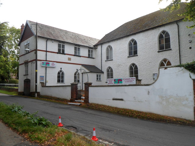
Image: © Jaggery Taken: 7 Oct 2012
Viewed across Church Road. The building was formerly a Congregational chapel built in the mid 18th century. On the left is the newer wing, built in the later 19th century. Inscribed on a small brown tablet on the wall on the left is CONGREGATIONAL CLASS ROOMS ERECTED 1895.
Images are licensed for reuse under creativecommons.org/licenses/by-sa/2.0
Image Location
Latitude
51.691291
Longitude
-2.353087