Flood Lane, Bridport
Introduction
The photograph on this page of Flood Lane, Bridport by John Stephen as part of the Geograph project.
The Geograph project started in 2005 with the aim of publishing, organising and preserving representative images for every square kilometre of Great Britain, Ireland and the Isle of Man.

There are currently over 7.5m images from over 14,400 individuals and you can help contribute to the project by visiting https://www.geograph.org.uk
Flood Lane, Bridport
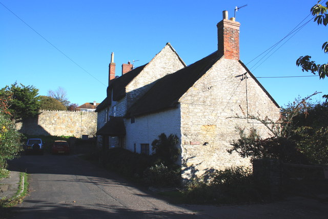
Image: © John Stephen Taken: 14 Oct 2012
Numbers 1 and 3 (Flood Cottage), Flood Lane, Bridport. On the other side of the stone wall at the end of the lane is the A35, Sea Road South. The main road runs along the line of the old railway line to West Bay (from Maiden Newton). Flood Lane used to continue underneath the railway embankment at this point and emerge into Bothenhampton along Hollow Way. A footpath leads up to the left and across the main road, but there is no installed crossing.
Images are licensed for reuse under creativecommons.org/licenses/by-sa/2.0
Image Location


Leaflet Map data © OpenStreetMap
Latitude
50.724806
Longitude
-2.756194