Nos 136-152 Beersbridge Road, Belfast (3)
Introduction
The photograph on this page of Nos 136-152 Beersbridge Road, Belfast (3) by Albert Bridge as part of the Geograph project.
The Geograph project started in 2005 with the aim of publishing, organising and preserving representative images for every square kilometre of Great Britain, Ireland and the Isle of Man.

There are currently over 7.5m images from over 14,400 individuals and you can help contribute to the project by visiting https://www.geograph.org.uk
Nos 136-152 Beersbridge Road, Belfast (3)
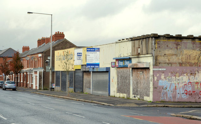
Image: © Albert Bridge Taken: 17 Oct 2012
See Image (December 2011). The buildings now have a “for sale” sign. Described by the agents as “Suitable for a number of residential / commercial uses (Subject to planning permission)”. This photograph appears as a matter of record only. I have no connection with any of the parties involved in the sale.
Images are licensed for reuse under creativecommons.org/licenses/by-sa/2.0
Image Location
Latitude
54.591977
Longitude
-5.896304