Railway south of Castle Bar Park station
Introduction
The photograph on this page of Railway south of Castle Bar Park station by Robin Webster as part of the Geograph project.
The Geograph project started in 2005 with the aim of publishing, organising and preserving representative images for every square kilometre of Great Britain, Ireland and the Isle of Man.

There are currently over 7.5m images from over 14,400 individuals and you can help contribute to the project by visiting https://www.geograph.org.uk
Railway south of Castle Bar Park station
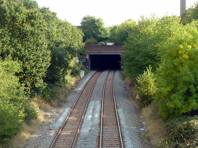
Image: © Robin Webster Taken: 13 Oct 2012
The apparent tunnel was formerly a cutting. It was roofed over with a concrete slab and part of the GLC's Copley Close Estate was built over it, opened in 1979. The southern part of the Copley Close road runs directly over the railway.
Images are licensed for reuse under creativecommons.org/licenses/by-sa/2.0
Image Location
Latitude
51.521617
Longitude
-0.33102