The River Lud reasserts its identity: sluice
Introduction
The photograph on this page of The River Lud reasserts its identity: sluice by Chris as part of the Geograph project.
The Geograph project started in 2005 with the aim of publishing, organising and preserving representative images for every square kilometre of Great Britain, Ireland and the Isle of Man.

There are currently over 7.5m images from over 14,400 individuals and you can help contribute to the project by visiting https://www.geograph.org.uk
The River Lud reasserts its identity: sluice
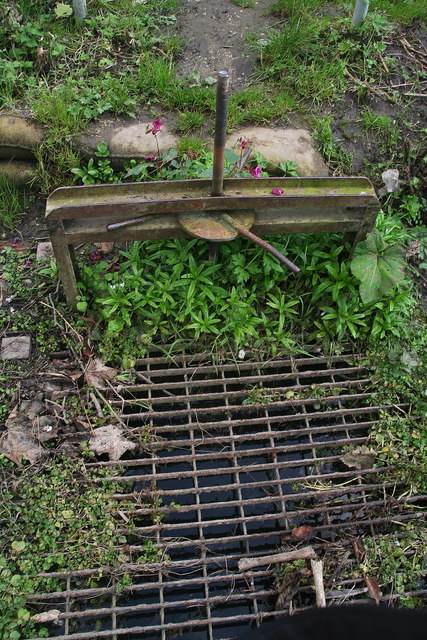
Image: © Chris Taken: 10 Oct 2012
The Louth Navigation takes its water from the River Lud, and the two combine for the first few hundred metres of the canal's course. This sluice is the point where a scaled-down version of the River Lud escapes to wind its way alongside the canal. The rushing, burbling sounds contrast with the smooth, silent progress of the water in the disused canal, and draw attention to the river's triumphant escape. A few Indian Balsam flowers linger on in October to adorn the sluice.
Images are licensed for reuse under creativecommons.org/licenses/by-sa/2.0
Image Location
Latitude
53.375604
Longitude
0.020798