Tiverton : Gold Street & Path
Introduction
The photograph on this page of Tiverton : Gold Street & Path by Lewis Clarke as part of the Geograph project.
The Geograph project started in 2005 with the aim of publishing, organising and preserving representative images for every square kilometre of Great Britain, Ireland and the Isle of Man.

There are currently over 7.5m images from over 14,400 individuals and you can help contribute to the project by visiting https://www.geograph.org.uk
Tiverton : Gold Street & Path
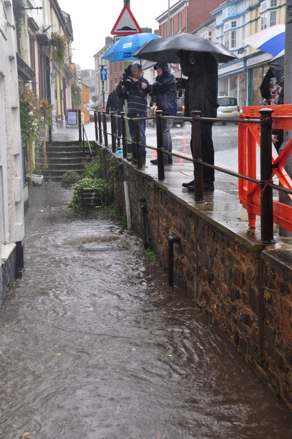
Image: © Lewis Clarke Taken: 11 Oct 2012
A path heads down off the main road to businesses which are today struggling with the flood.
Images are licensed for reuse under creativecommons.org/licenses/by-sa/2.0
Image Location


Leaflet Map data © OpenStreetMap
Latitude
50.903251
Longitude
-3.483966