Narrows on the Worcester & Birmingham Canal
Introduction
The photograph on this page of Narrows on the Worcester & Birmingham Canal by Christine Johnstone as part of the Geograph project.
The Geograph project started in 2005 with the aim of publishing, organising and preserving representative images for every square kilometre of Great Britain, Ireland and the Isle of Man.

There are currently over 7.5m images from over 14,400 individuals and you can help contribute to the project by visiting https://www.geograph.org.uk
Narrows on the Worcester & Birmingham Canal
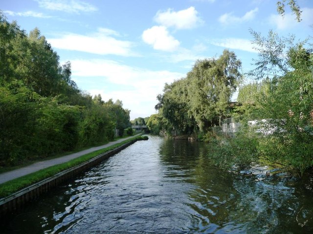
Image: © Christine Johnstone Taken: 4 Sep 2012
'Narrows' are places where a canal is intentionally built at its minimum width. Sometimes they are the site of a demolished bridge. More often [and I think in this case] they are points where stop planks can be dropped in across the canal, to close it. This would stop all the water draining out of a long pound if there was a breach somewhere.
Images are licensed for reuse under creativecommons.org/licenses/by-sa/2.0
Image Location
Latitude
52.432716
Longitude
-1.928473