Housing in Kidsgrove, Staffordshire
Introduction
The photograph on this page of Housing in Kidsgrove, Staffordshire by Roger D Kidd as part of the Geograph project.
The Geograph project started in 2005 with the aim of publishing, organising and preserving representative images for every square kilometre of Great Britain, Ireland and the Isle of Man.

There are currently over 7.5m images from over 14,400 individuals and you can help contribute to the project by visiting https://www.geograph.org.uk
Housing in Kidsgrove, Staffordshire
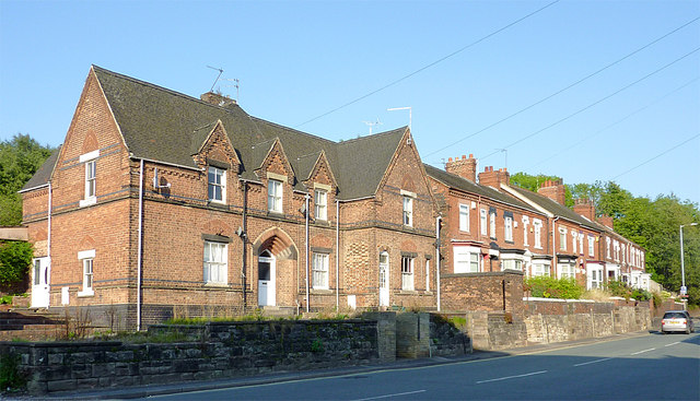
Image: © Roger D Kidd Taken: 1 Sep 2011
These are in Liverpool Road, the A50 approaching Kidsgrove town centre. The fine building (now three separate dwellings) nearest the camera is shown on old maps as a police station. Gordon Hassall reports that the station was probably closed in 1975 or 1976. http://www.bbc.co.uk/history/domesday/dblock/GB-384000-354000/page/19
Images are licensed for reuse under creativecommons.org/licenses/by-sa/2.0
Image Location
Latitude
53.087404
Longitude
-2.242566