Drinking trough
Introduction
The photograph on this page of Drinking trough by Peter Turner as part of the Geograph project.
The Geograph project started in 2005 with the aim of publishing, organising and preserving representative images for every square kilometre of Great Britain, Ireland and the Isle of Man.

There are currently over 7.5m images from over 14,400 individuals and you can help contribute to the project by visiting https://www.geograph.org.uk
Drinking trough
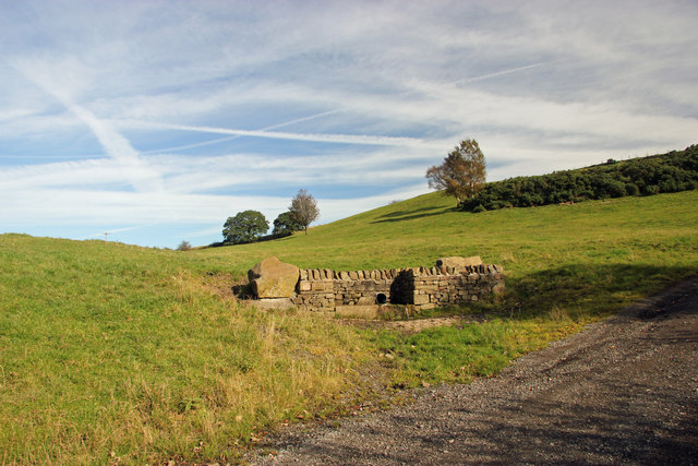
Image: © Peter Turner Taken: 9 Oct 2012
Apparently spring fed this elegant construction of locally quarried stone with cobbled area by the side of the access road is a far cry from the usual muddy morass extending some distance around. It probably also helps avoid the driveway icing over in the winter.
Images are licensed for reuse under creativecommons.org/licenses/by-sa/2.0
Image Location
Latitude
53.220429
Longitude
-2.111387