St. Pauls on the Hill : Toronto
Introduction
The photograph on this page of St. Pauls on the Hill : Toronto by Hugh Mortimer as part of the Geograph project.
The Geograph project started in 2005 with the aim of publishing, organising and preserving representative images for every square kilometre of Great Britain, Ireland and the Isle of Man.

There are currently over 7.5m images from over 14,400 individuals and you can help contribute to the project by visiting https://www.geograph.org.uk
St. Pauls on the Hill : Toronto
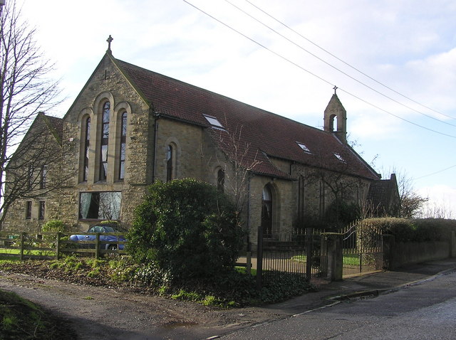
Image: © Hugh Mortimer Taken: 21 Jan 2007
Former Church (now a private residence) (dated 1903). Toronto was named by WC Stobart (after the Canadian City) whose mining company built the village (1859) for the miners and their families. By 1894, Toronto Colliery was working four seams, with 500 men and boys employed. The colliery closed in the late 1920's, and reopened by the Bitchburn Fireclay Co.Ltd in 1937. At its peak in 1950, it employed 119 men. In 1967, it employed 70 men and 18 pit ponies, but closed soon after.
Images are licensed for reuse under creativecommons.org/licenses/by-sa/2.0
Image Location


Leaflet Map data © OpenStreetMap
Latitude
54.669084
Longitude
-1.688319