St Michael's Church, Warmington
Introduction
The photograph on this page of St Michael's Church, Warmington by David P Howard as part of the Geograph project.
The Geograph project started in 2005 with the aim of publishing, organising and preserving representative images for every square kilometre of Great Britain, Ireland and the Isle of Man.

There are currently over 7.5m images from over 14,400 individuals and you can help contribute to the project by visiting https://www.geograph.org.uk
St Michael's Church, Warmington
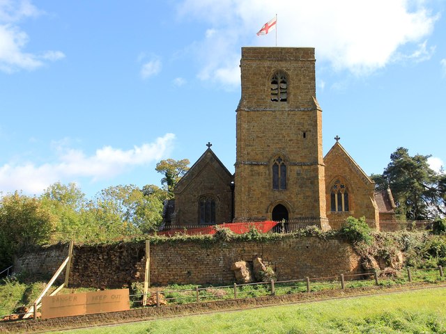
Image: © David P Howard Taken: 3 Oct 2012
The west side of the church from across the small section of dual carriageway that forms Warmington Hill. The retaining wall around the churchyard appears to have suffered a partial collapse. This may have been due to recent unusually heavy rains. http://www.achurchnearyou.com/warmington-st-michael/ http://www.britishlistedbuildings.co.uk/en-306297-church-of-st-michael-warmington-warwicks
Images are licensed for reuse under creativecommons.org/licenses/by-sa/2.0
Image Location
Latitude
52.124031
Longitude
-1.40313