Elm Walk
Introduction
The photograph on this page of Elm Walk by Alan Walker as part of the Geograph project.
The Geograph project started in 2005 with the aim of publishing, organising and preserving representative images for every square kilometre of Great Britain, Ireland and the Isle of Man.

There are currently over 7.5m images from over 14,400 individuals and you can help contribute to the project by visiting https://www.geograph.org.uk
Elm Walk
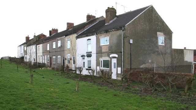
Image: © Alan Walker Taken: 17 Jan 2007
These houses are on Elm Walk. There is no road leading to the fronts of these houses although Elm Road, behind, does give access to the backs. The path to the fronts is from Image The outlook from these dwellings used to be over a small field (part of which can be seen, left and bottom, in the photograph) toward Image However, thanks to Millennium Funding, a Image for the school and local community was built of part of the land. Off the left of the picture, opposite the houses at the end of the walk, is a Image
Images are licensed for reuse under creativecommons.org/licenses/by-sa/2.0
Image Location


Leaflet Map data © OpenStreetMap
Latitude
53.153989
Longitude
-1.366669