Mortimer's Cross Watermill - meal floor
Introduction
The photograph on this page of Mortimer's Cross Watermill - meal floor by Ashley Dace as part of the Geograph project.
The Geograph project started in 2005 with the aim of publishing, organising and preserving representative images for every square kilometre of Great Britain, Ireland and the Isle of Man.

There are currently over 7.5m images from over 14,400 individuals and you can help contribute to the project by visiting https://www.geograph.org.uk
Mortimer's Cross Watermill - meal floor
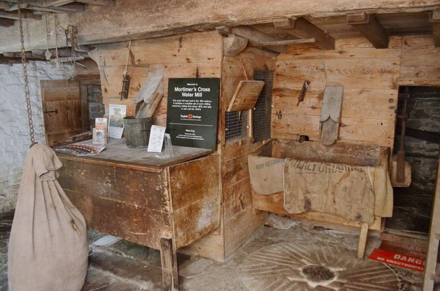
Image: © Ashley Dace Taken: 30 Sep 2012
A view of the meal floor, several stones are in the base. The one seen here is 1690 based on the grooves for the rynd on the upper stone. From the 1700s the 'Spanish cross' design was adopted. Both the pre and post 1700s designs are on this stone. It probably comes from another mill before this one on the same site.
Images are licensed for reuse under creativecommons.org/licenses/by-sa/2.0
Image Location


Leaflet Map data © OpenStreetMap
Latitude
52.268811
Longitude
-2.841837