Lawrence Hill flush bracket
Introduction
The photograph on this page of Lawrence Hill flush bracket by Neil Owen as part of the Geograph project.
The Geograph project started in 2005 with the aim of publishing, organising and preserving representative images for every square kilometre of Great Britain, Ireland and the Isle of Man.

There are currently over 7.5m images from over 14,400 individuals and you can help contribute to the project by visiting https://www.geograph.org.uk
Lawrence Hill flush bracket
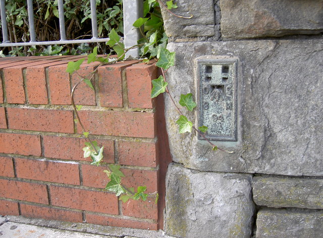
Image: © Neil Owen Taken: 1 Oct 2012
A flush bracket on the bridge over the railway station, number 94 in the line from Flax Bourton to Sharpness and is from the Second Geodetic Levelling, dating from the early part of the twentieth century. See http://www.bench-marks.org.uk/bm9762 for the entry in the Benchmark Database and Image] for a wider view.
Images are licensed for reuse under creativecommons.org/licenses/by-sa/2.0
Image Location
Latitude
51.457945
Longitude
-2.564731