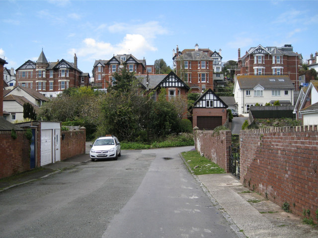
Higher Brimley from Lower Brimley Close
Introduction
The photograph on this page of Higher Brimley from Lower Brimley Close by Robin Stott as part of the Geograph project.
The Geograph project started in 2005 with the aim of publishing, organising and preserving representative images for every square kilometre of Great Britain, Ireland and the Isle of Man.
There are currently over 7.5m images from over 14,400 individuals and you can help contribute to the project by visiting https://www.geograph.org.uk

Image: © Robin Stott Taken: 6 May 2012
The floor of the Brimley valley could only be developed once the Brimley Brook (aka River Tame) had been culverted. Lower Brimley Close is characteristic ad hoc development in the valley, while older housing marches in an orderly fashion up and along the hillsides. Detached and semi-detached polychrome villas look down from Higher Brimley.

